MT McCoy Hike in Simi Valley (MT McCoy, Reagan Library, Cross on the Hill)
(Some images taken from MSN Live maps. They have great Bird's Eye views.
Some trail details taken from Simi
Trailblazers website.)
I hiked MT McCoy with 2 other LAHikers friends on Sunday, June 22, 2008. As there isn't much info on the Internet, this is my attempt to share this one of the most beautiful family hikes in Simi Valley, California with visitors like you. This is a nice hike for families with young kids. I started taking my son Arian on this hike when he was 2 years and 4 months.
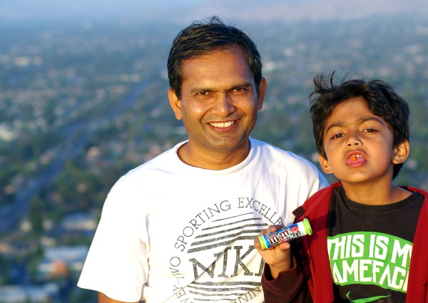
MT McCoy = MM = M&M
Whenever I hike on MT McCoy with Arian, I try to bring a pack of M&M candies. When he was very young, probably this M&M candy also played a role in motivating him. Now in my family, this is an M&M hike and it makes sense too as this is MT McCoy (MM) hike.
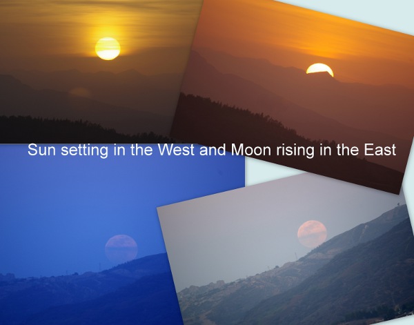
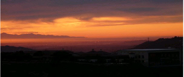
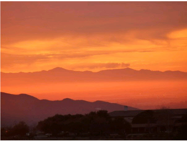
Before I jump to more details about the trailhead and the hike, let me say one thing. This hike can be done in an hour if you start doing it as your daily or weekly workout. Top of the MT McCoy also offers fantastic views of the city of Simi Valley (including Wood Ranch), the Presidential library and the Air Force One plane inside it, and Pacific Ocean and Channel Islands on a clear day. Besides the views, the sunsets are amazing from this hill. And on a full moon day, you (and your kids) will love to watch the Sun set in the West and the Moon come out of the mountains in the East. Here is a photo of the Sun and the Moon taken around 10 minutes apart on May 24, 2013.
Update: This has become by weekly routine. I love to hike this hill usually in the evenings to watch beautiful sunsets. I go up on the strenuous red route- around 18 minutes. I spend around 20 minutes on the top enjoying nice 360 views, and then I come back on the green route- another 20 minutes. An hour very well spent.
Please click here if you want to see some of the sunset photos I took from this hike.
Hike Details:
This hike is around 2 miles but can be extended up to 4-5 miles by
including Ronald Reagan pubic library. When you start this hike, you
have 3 choices as such.
(i) Go on the shortest and strenuous route (Red arrows below)- around
1.2 miles round trip but a really good workout. Elevation gain around
600 feet. Almost every step is going up!!! Should take around 20 minutes
going up on this quickest route but I have seen high school kids run
up in around 8 minutes. Going down will take around 15 minutes. (ii)
Or take the GREEN path which is around 3 miles round-trip- pleasant
hike with lot of short cuts available. Recommended for most first time
hikers and also for families hiking with kids as young as 4-5 years
old (iii) Or make it a loop. You can do it either way. (a) If you choose
to take the difficult part first, it can really tire you but the coming
back to your car will be very easy. This is my favorite route. (b) If
you take the Green path first, you will love it but going down on the
red path below will require you to be very careful. Not very difficult
but it does need good shoes and good deal of care while going down on
the steep slope.

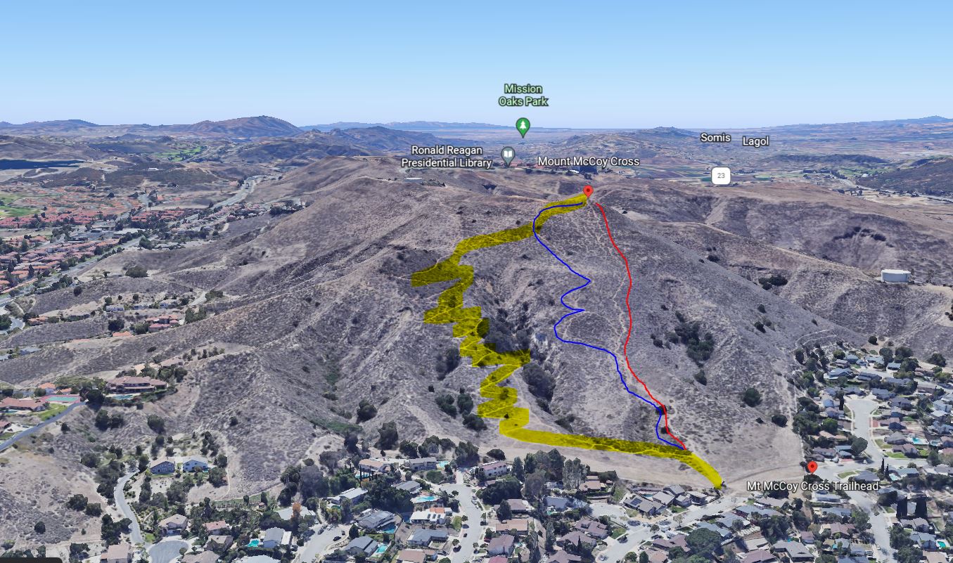
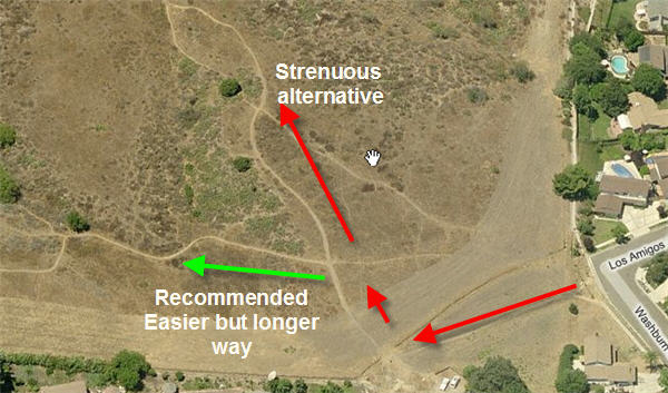
We call the most difficult trail as McCoy 1.0, shown in red in the image below. At 1/3 or 1/4th of that route, you can make it a bit easier by taking the blue trail, which we call 1.5. Or, follow the yellow, highlighted trail to make it easy fun relaxing and meditative. We lovingly call it McCoy 2.0.
1.0 is around 0.4 miles (my guess), 1.5 is arouond 0.6-0.7 miles. 2.0 is around 1.25 miles but with short cuts on the way, you can make it around 1 mile or less. Please note that all these routes have same elevation- around 550 feets. If you fit, 1.0 will take around 15 minutes, 1.5 should take around 20 minutes and 2.0 should take 25-30 minutes.
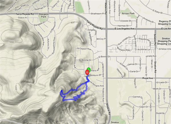
Trail Map:
Here is one more image:
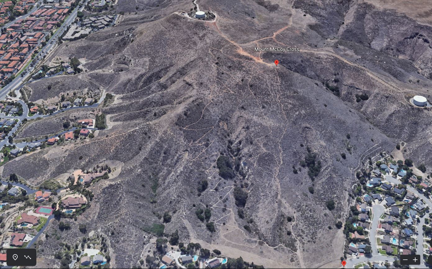
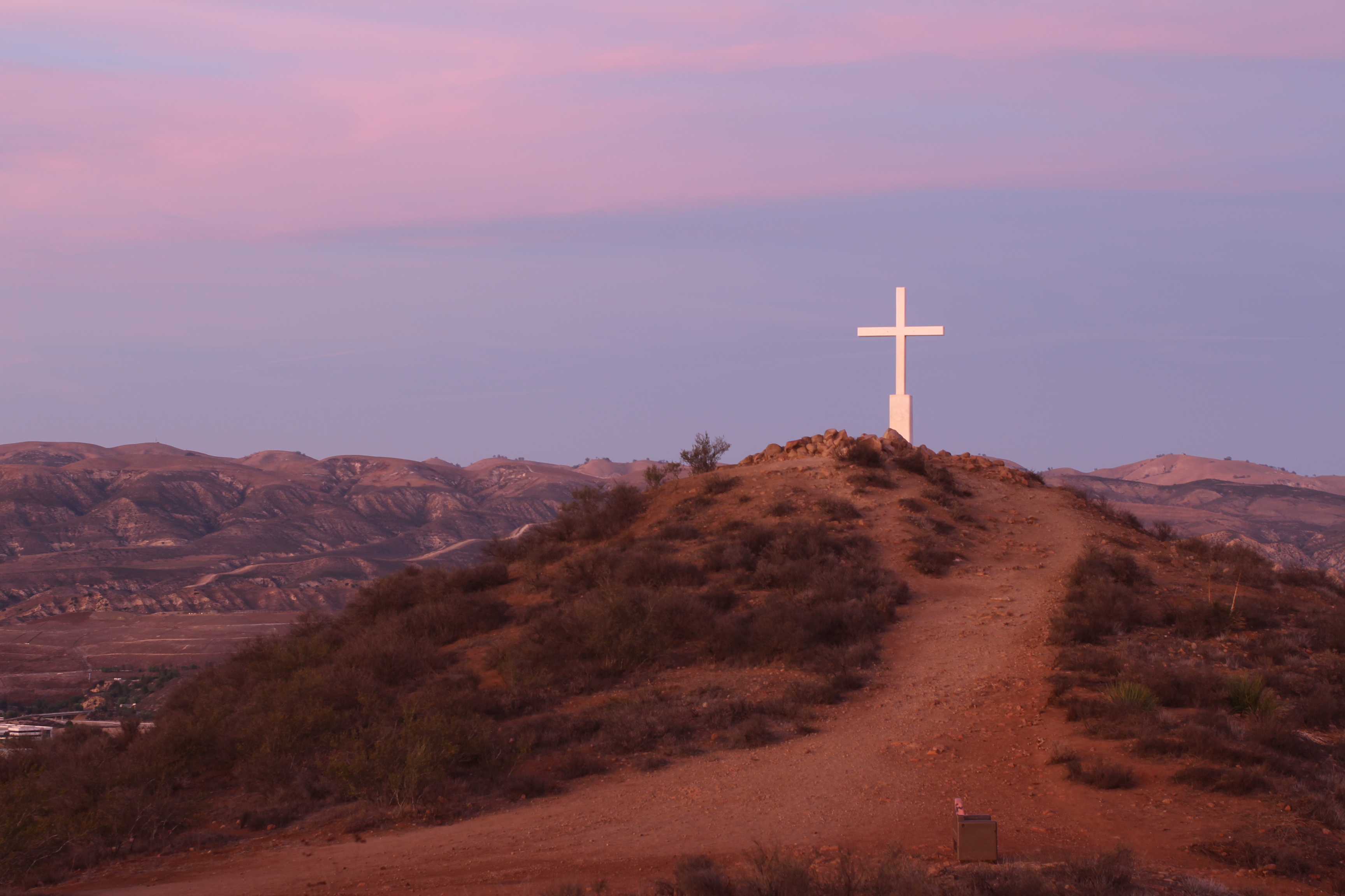
Mt. McCoy is the hill with the white cross on it at the western end of Simi Valley. Beginning at the open space on the outside of the curve, the trail (GREEN Arrows above) extends to the south-southwest across grasslands along the base of the hills. After crossing a drainage bottom, the trail begins to climb via many switchbacks through coastal sage scrub and then through chaparral. Each northern switchback abuts up against a steep, oak-studded canyon.
The trail comes to a saddle by a knoll and then climbs through nine
more switchbacks, terminating just south of the cross. The trail is
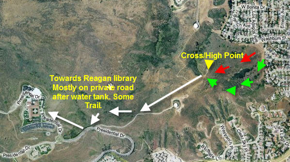
1.3 miles long and climbs 500-600 feet to the cross. From there, a dirt
track extends to the south and over towards the Ronald Reagan Presidential
Library and Museum. Another track extends northerly down the mountain,
eventually to connect with Tierra Rejada Road. The Rancho Simi Recreation
and Park District currently owns 200 acres around Mt. McCoy. Climbing
the trail, there are magnificent views of Simi Valley. From the top,
there are panoramic views in all directions, including views of the
Presidential Library, the Channel Islands, Wood Ranch, and Old Boney
Mountain. On a clear day, one can see the ocean. We recommend you should
bring water, sunscreen, a hat, dark glasses and hiking shoes. Dress
for the weather.
Technical Specs of the Hike
for going up straight- tough way and coming down the zig-zag way. Refer
to the map below:
Distance: 1.32 miles
Elapsed Time: 1:04:51
Avg Speed: 1.2 mph
Max Speed: 4.6 mph
Avg Pace: 49' 10" per mile
Min Altitude: 666 ft
Max Altitude: 1,227 ft
Start Time: 2010-02-08T00:36:32Z
Start Location:
Latitude: 34.264876� N
Longitude: 118.799574� W
End Time: 2010-02-08T01:41:24Z
Latitude: 34.264567� N
Longitude: 118.799831� W
Larger Hiking Alternative:
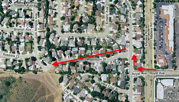
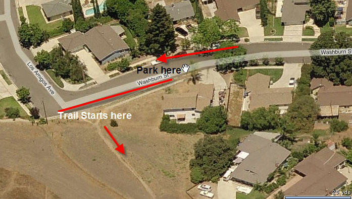
Directions to Trailhead:
The Mt. McCoy Trail begins at the western end of Washburn Street. To get there, you take Royal Avenue west of Madera Road, take a right at the "T" intersection with Acapulco Avenue and an immediate left onto Washburn. The trail begins where Washburn curves and becomes Los Amigos Avenue.
Visit Simi
Trailblazers website for more details on this hike
HISTORY
Tradition suggests that a cross has existed atop Mt. McCoy since the early 1800s, when the cross served both as a religious symbol and as a beacon on the El Camino Real (King's Highway). Travelers between San Fernando and San Buenoventura Missions rested along the way at El Rancho Simi, as did Alfred Robinson, as he described in Life in California. A survey map (Norris, Washington and Hancock) from 1858-59 includes a note, "wooden cross," at or near the location of the present-day cross. The Runkle family recalled a small stone cross on the hill when the family arrived in the valley in 1904. The stone cross was said to have been placed there by a sheepherder. The discovery of the 1858-59 map, inspired R.E. Harrington, in 1921, to re-establish a cross on the hill. His Sunday School class of 12-year-old boys carried the timbers for the cross up the hill. The main timber was 2 inches x 12 inches and 20 feet long. Easter sunrise services were held there for 47 years. The existing reinforced concrete cross is said to have been placed there in 1941. A large blowup of a 1947 Easter Sunday picture taken from atop of Mt. McCoy, complete with cars on the dirt access road and a steam engine on the railroad, hangs in City Hall. Poor access led to the abandonment of sunrise services. However, today the Rotary Clubs in Simi Valley illuminate the cross during Easter week. Mt. McCoy received its name from C. B. McCoy, who purchased the Canada Verde Ranch, about 5,000 acres, from the Simi Land and Water Company in about 1898. At that time the hill was still known as "Verde Hill," a name that had persisted from the Spanish-Mexican period. ("Verde" means "green" in Spanish.) The current trail to Mt. McCoy was cut under the direction of the Rancho Simi Trail Blazers on National Trails Day on June 7, 1997.
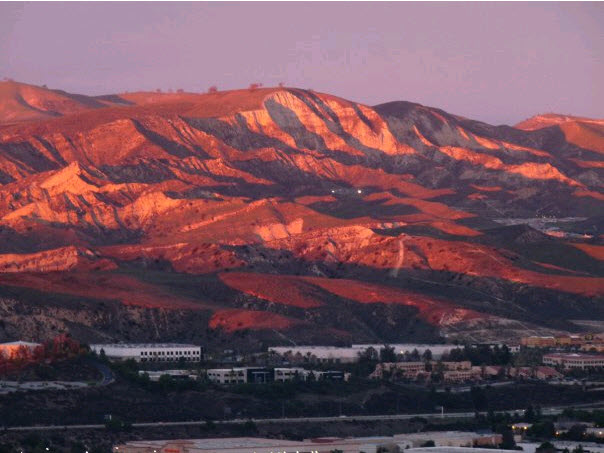
Here are some pictures of the trail. You will see some great panoramic views of Simi Valley from the top of MT McCoy.
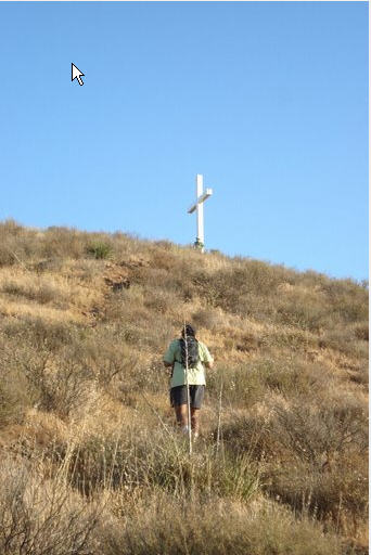
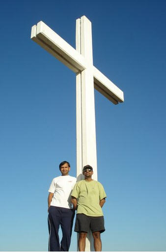
The Cross is really tall. See a man standing next to it in above photo.
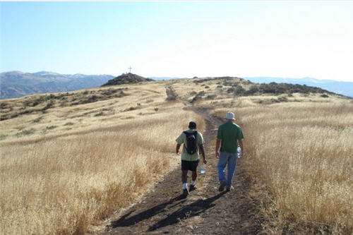
Walking towards the cross from Ronald Reagan Public Library
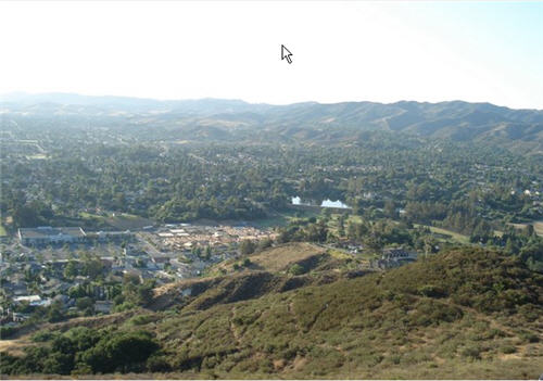
View of Simi Valley from the top:
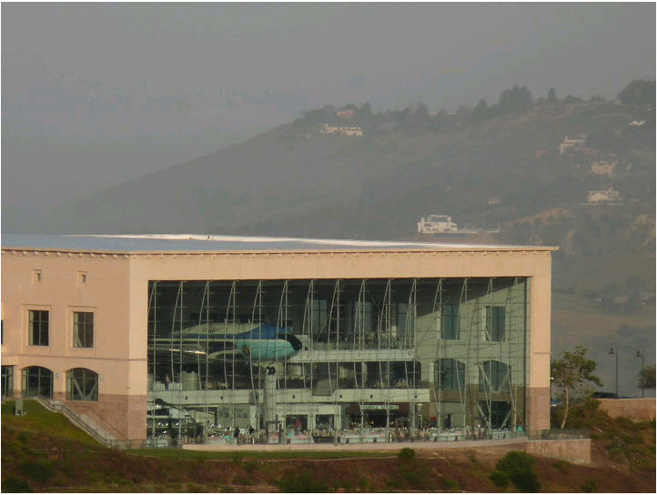
"Air Force one", Presidential Library, Ronald Reagan Public
Library, Simi Valley- photo from MT McCoy
Sunset Photos taken from MT McCoy
White-face mountain, Simi valley Mall, from MT McCoy: