Cheeseboro Canyon Hiking
Cheeseboro Canyon is a part of National Park Service (NPS)- Santa Monica Mountains Recreation Area (www.nps.gov/samo).
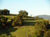
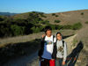
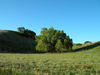
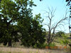
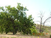
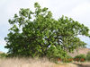
This is a waste area of open land, beautiful views with Oak Trees, hills, rock formations, water stream, wild flowers. It has 20 plus miles of hiking trails. I would recommend following 4 trails for most people. This is also a great area for mountain bikers- for biking and also for horse riding. This area is very easy to access from freeway and offers variety of trails for different age and ability groups.
1. Simi Peak Trail
2. Palo Comado/Cheeseboro Loop
3. Palo Comado/Chesseboro Loop 2
4.Cheeseboro Chanyon/Canyon View Trail
Here are some details for the
"4.Cheeseboro Chanyon/Canyon View Trail"
How to reach there?
Take 101 and exit on Chesbro Canyon in Agoura Hills. Go north on Palo
Comado Canyon Rd and then take Right on Chesebro Road. You will see
an NPS parking lot. Park your car there.
Type of Hike:
Best for families with young kids. It has nice balance of elevation,
beauty and length.
Trail Directions:
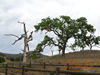
First go around a mile on the Cheeseboro Canyon Trail. This is a nice
easy walk paraller to a water stream and trees. Then you will see a
sign for Canyon View Trail on your Right. Canyon View Trail is a 0.7
mile, moderately strenuous- This trail splits to the east of the Cheeseboro
Canyon Trail and climbs to a knoll above the Lost Hills landfill. Looking
back towards the west, you can see most of Cheesboro Canyon. The Canyon
View Trail ends in Cheeseboro Ridge Trail. At the meeting point, you
will see a nice upward sloping hike on the right hand side (south).
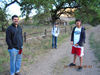
Go up and you will have nice views of Cheeseboro Canyon, Simi Peak on
the North, Agoura Hills on the South, Thousand Oaks- OakPark on the
West and 101 Freeway/Malibu Canyon on the East. Take a look at the Flash
of the 360 degree views from this high point. (Click on the Flash object
and with mouse,you should be able to control the speed and with left
click, you should be able to ZOOM IN too.)
On the way back, take Modelo connector to Modelo trail and come back to your car.
First, if you browser runs Flash objects, here is a 360 degree view from next to Canyon Ridge Trail- Weather Station.
Cheesebro |
DSCN6444.JPG |
DSCN6422.JPG |
DSCN6424.JPG |
DSCN6425.JPG |
DSCN6426.JPG |
DSCN6428.JPG |

DSCN6433.JPG |
DSCN6437.JPG |
DSCN6441.JPG |
DSCN6443.JPG |
Details about various parts of Cheeseboro/Cheesbro Hiking Area:
Modelo Spur 0.7 mile, moderate-This trail meanders from the parking lot through grasslands to a lone coast live oak on the ridge. The trail drops east and joins the Cheeseboro Canyon Trail.
Modelo Trail 1 mile, easy-Starting at the ridge line of the Modelo Spur and continuing north along the ridge, this pathway offers views of both canyons. It ends at the Palo Comado Connector Trail where you can turn right, and travel east to Cheeseboro Canyon, or left, and travel west to Palo Comado Canyon.
Palo Comado Canyon Trail 4.4 miles, moderate to strenuous-The first 1.2 miles of this trail are a gentle stroll along a creek to the old ranch center. The dramatic elevation gain begins a mile past the ranch site where you will climb from 1,200 feet elevation to scenic China Flat at 2,140 feet elevation.
Palo Comado Connector 1.5 miles, moderate-Travel this old ranch road across the ridge and through a section of Modelo Shale to reach either Cheeseboro or Palo Comado Canyons.
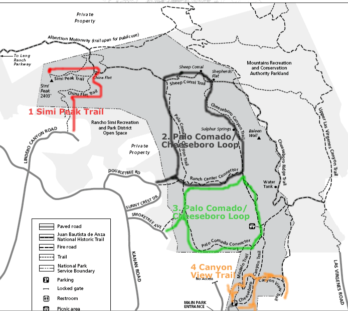
Cheeseboro Canyon Trail 4.6 miles, easy- Follow an old ranch road along a streambed through a valley oak savannah and coast live oak riparian zone. A picnic area is located 1.6 miles from the parking lot. Near Sulphur Springs, at 3.3 miles, you can smell the odor of rotten eggs. As you pass under the Baleen Wall, the canyon opens up and chaparral slopes replace the savannah. The trail continues to an old sheep corral where you can picnic near the creek bed or watch the sky for birds of prey.
Canyon View Trail 0.7 mile, moderately strenuous- This trail splits to the east of the Cheeseboro Canyon Trail and climbs to a knoll above the Lost Hills landfill. Looking back towards the west, you can see most of Cheesboro Canyon.
Ranch Center Connector 1.1 miles, moderate to strenuous-This trail crosses a chaparral hillside and connects Cheeseboro and Palo Comado Canyons. Simi Peak Trail 0.8 mile, moderate-This trail winds from China Flat to Simi Peak, the highest point in the area. Enjoy a spectacular view of Oak Park, Agoura Hills and Simi Valley.

